
Italian National Research Council
Department of Earth Observation
| Home |
| Projects |
| ORM for MIPAS |
| ASSET |
| AMIL2DA |
| MIPAS special modes |
| Marschals |
| Products |
| Events |
| Publications |
| Team |
| News on analysis of MIPAS measurements on ENVISAT | ||||||||
| MIPAS (Michelson Interferometer
for Passive Atmospheric Sounding) is
operating on ENVISAT since March 2002.
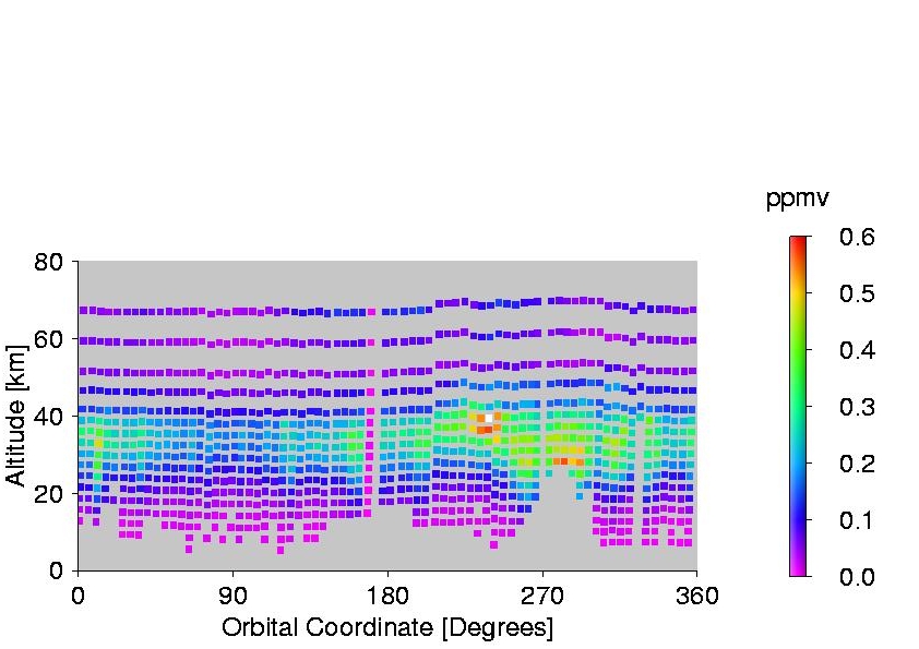
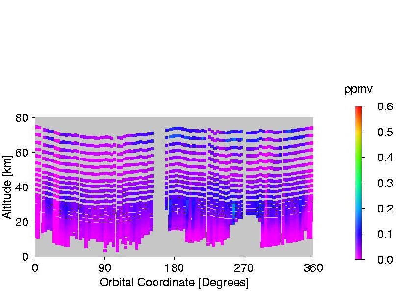
After two years of nearly continuous limb-scanning measurements (from July 2002 to March 2004) at the end of March 2004 the instrument was stopped due to problems with the mirror drive of the interferometer. Operations with reduced maximum path difference, corresponding to both a lower spectral resolution (0.0625 cm-1 instead of 0.025 cm-1 ) and a shorter measurement time (1.8 sec instead of 4.5 sec), were tested for one month in August/September 2004 and then definetely resumed on January 2005. In order to exploit the reduction in measurement time a change in the measurement scenario was also implemented for measurements from January 2005 on. The new scenario adopts a finer vertical limb scanning step in the region of the troposphere and lower stratosphere. From the first analysis of the new measurements it results that these measurements are characterised by both an improved vertical resolution and a smaller estimated standard deviation.   Vertical
resolution for the ozone
retrieval, as a function of altitude and orbital coordinate, for both
the orbit
#17540, acquired with the new operation mode (plot on the right), and
the orbit
#7090, acquired with the old operation
mode (plot on the left) . The orbital coordinates are linked to
latitude and
are equal to 0° and 180° at the equator, to 90° at the
North pole and to 270° at
the
South pole.
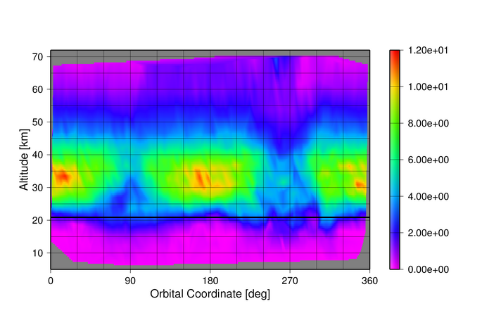
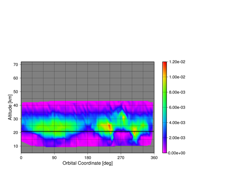
  Retrieval
errors for the ozone
retrieval, as a function of altitude and orbital coordinate, for both
the orbit
#17540, acquired with the new operation mode (plot on the right), and
the orbit
#7090, acquired with the old operation
mode (plot on the left).
In general we obtain for all species that in the new operation mode the retrieval errors are smaller than in the old operation mode and the vertical resolution is significantly improved (in troposphere and stratosphere vertical resolution is often smaller than the IFOV). This result has been obtained despite the improved vertical and horizontal resolution. Indeed, the distribution of the coloured spots along the orbital coordinate shows that also the horizontal sampling has improved. Latest news on ENVISAT. MIPAS instrument availability. MIPAS October 2003 movie An overview of the multidimensional measurements of MIPAS: global maps (latitude and longitude) of the target species, resolved in altitude and viewed as a function of time. 2003 Ozone hole movie Here you can download the movie (1.2 MB) of ozone hole and nitric acid behavior at 21 km altitude over Antarctica in the period 13 September - 15 December 2003 (MIPAS near real time data). MIPAS measurements, re-analysis Maps of volume mixing ratio (ppmv) of ozone and nitric acid on 30-31 August 2003 (ORM re-analysis of MIPAS measurements).
|
||||||||
Maps on the left correspond to the orbit indicated in black on the world maps. Maps on the right correspond to the altitude indicated by the black line on the left maps. |
||||||||
| The orbital coordinate is related to the latitude and
its value is 0 and 180 at the equator and 90 and 270 respectively at
the north pole and at the south pole. |
||||||||


Maps of 30-31 August 2003 for:
Temperature
H2O
O3
HNO3
CH4
N2O
NO2
ClONO2
N2O5
CFC-11
CFC-12